Transform your Android device into the ultimate outdoor GPS companion with the Spain Topo Maps app. Whether you're setting off on a backcountry adventure or exploring the stunning landscapes of Spain, this app is your go-to guide. With access to top-quality topographic maps and aerial images, including those of the Balearic and Canary Islands, you can confidently navigate even in areas without cell service. The app offers a diverse selection of map layers, from Spain's national topo map to crowdsourced OpenStreetMaps and ESRI maps, ensuring you have the best possible coverage. Create and edit waypoints, record tracks, and export your data in various formats with ease. For an enhanced experience, upgrade to the Pro version, which offers offline capabilities and the ability to bulk-download map tiles. No matter your outdoor pursuit, from hiking to skiing, Spain Topo Maps is the perfect companion for all your adventures.
Features of Spain Topo Maps:
Offline GPS Navigation: Enjoy uninterrupted navigation for your outdoor activities, even without cell coverage. Your Android device becomes a reliable GPS for backcountry trips.
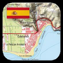
Topographic Maps and Aerial Images: Gain access to the finest topographic maps and high-resolution aerial imagery for Spain, encompassing the Balearic and Canary Islands.
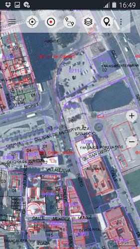
Multiple Map Layers: Choose from an extensive array of map layers, including Spain Topo Map, IGN Base Map, Spain Imagery, Catalonia Topo Maps, Land Register Map, OpenStreetMaps, OpenCycleMaps, ESRI Topographic, ESRI Aerial Images, ESRI Street Map, Google Road Map, Google Satellite Images, Google Terrain Map, Bing Road Map, Bing Satellite Images, and Earth At Night.
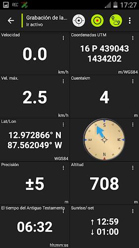
Outdoor Navigation Tools: Utilize features such as creating and editing waypoints, GoTo-Waypoint-Navigation, track recording with detailed speed, elevation, and accuracy profiles, a tripmaster with odometer, average speed, bearing, elevation, and more. The app supports GPX/KML/KMZ export, search for placenames, POIs, and streets, customizable data fields in map view and trip master, sharing of waypoints, tracks, or routes, displaying coordinates in various formats, and track replay.
Pro Features: Opt for an in-app purchase to unlock advanced features like offline use, fast bulk-download of map tiles for offline use, creating and editing routes, route navigation, GPX/KML/KMZ import, unlimited waypoints and tracks, adding other map tile servers, and an ad-free experience.
Preload FREE Map Data: Preload free map data for areas without cell service, ensuring you're never without maps, even in remote locations.
Conclusion:
With its multiple map layers and customizable data fields, Spain Topo Maps enhances your outdoor navigation experience. The Pro features further elevate your adventures by enabling offline use and advanced navigation capabilities. Whether you're hiking, biking, camping, or engaging in any outdoor activity, Spain Topo Maps is an essential tool for explorers. Click to download and maximize your outdoor adventures in Spain.


7.2.2
17.18M
Android 5.1 or later
com.atlogis.spain